

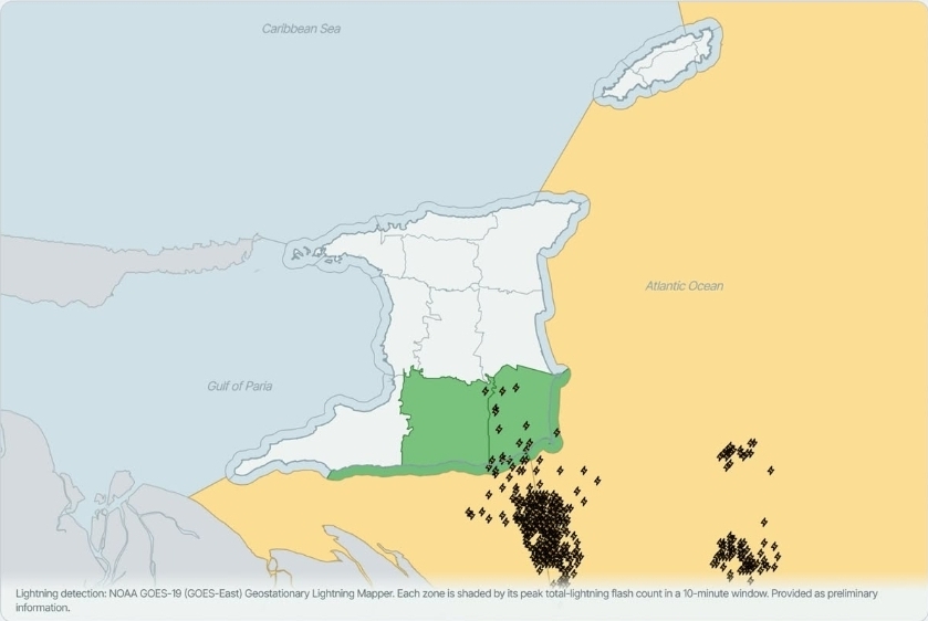
During the early evening, satellite and radar systems logged over 500 lightning strikes over Trinidad’s southeastern coastline. The flashes were visible across central and southern regions, creating a dramatic nocturnal display that attracted the attention of residents and meteorologists alike. The event, recorded between 10:15 and 11:00 p.m., reflects the intensity of the current thunderstorm system.
Accompanying the lightning, heavy rainfall poured into the southern and eastern districts. Slow‑moving showers and thunderstorms pushed additional precipitation onto the island’s interior, while light to moderate rain fell elsewhere. In eastern Tobago, the same weather pattern brought misty clouds and steady drops, raising concerns for low‑lying coastal communities.
Local authorities have issued warnings to residents in flood‑prone areas, urging them to avoid low‑lying roads and to secure outdoor items. While no major damage has been reported, minor flooding has already appeared in some neighborhoods, and power lines have been reported down in isolated spots. Emergency services remain on standby to respond to any incidents.
The Trinidad & Tobago Weather Center continues to monitor the evolving system and will issue updates as conditions change. Residents are encouraged to check the official forecast for real‑time information on rainfall totals, wind speeds, and potential flooding alerts. The forecast can be accessed via https://ttweathercenter.com/forecast/.
Scientists note that the current storm cluster is part of a larger tropical disturbance affecting the Caribbean region. As the system moves inland, forecasters anticipate a gradual decrease in lightning activity but sustained rainfall, especially in the southern and eastern provinces. Community leaders stress preparedness and recommend staying informed through local news outlets and weather alerts.